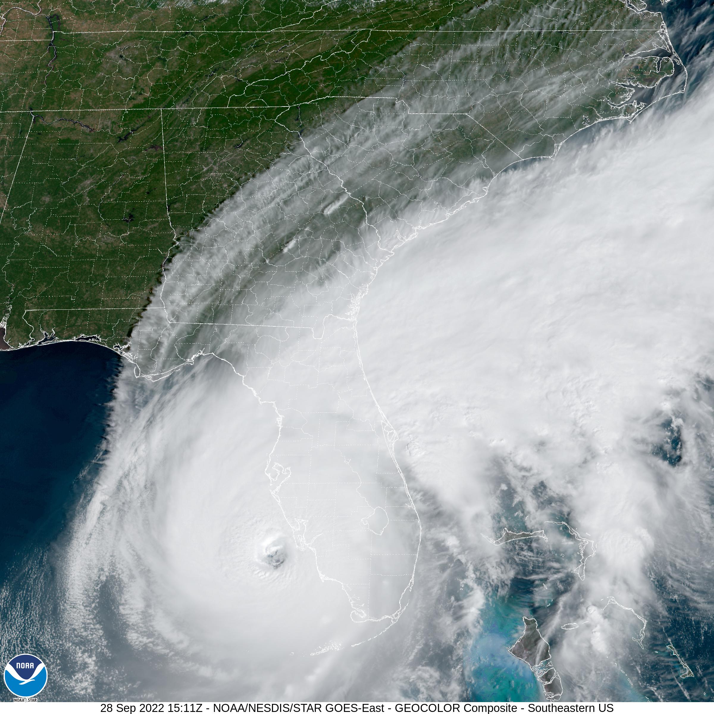
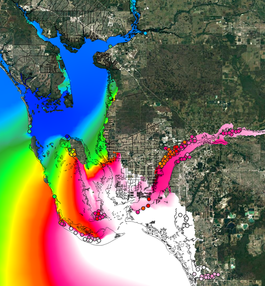
Hurricane Ian Fast Response Hindcast
In order to support hurricane recovery activities and to improve future resiliency, Oceanweather (OWI) routinely produces “fast-response” tropical cyclone hindcasts for significant storms and has started work on the extremely destructive 2022 hurricane Ian. A detailed reanalysis of the conditions experienced in a land-falling hurricane are required in any ocean response modeling to provide critical guidance on the extent of the storm wave and surge inundation. OWI can provide wind, pressure, and/or OWI’s standard wave fields for these events.
As experts in providing meteorological forcing for ocean response modeling of extreme wind, wave and storm surge events, OWI has a long history of quickly responding to the need for hindcasts of recent or active tropical events. This expertise is also applied in long-term operational and storm hindcasts in public and private sectors around the globe.
OWI’s tropical cyclone hindcast expertise, experience, and capabilities are well documented in publications, presentations and existing metocean studies. Similar previous fast-response hindcasts include Katrina and Rita in 2005, Sandy in 2012, Harvey in 2017, Laura in 2020, and other landmark storms. These hindcasts have been used by industry and academia, often as the source of high quality reference winds for detailed storm surge modeling. Further details and related papers can be found on our web site at the following links:
• Fast Response Tropical Modeling
• Publications and Presentations
Those wishing to obtain fast response tropical storm hindcast data can contact Erin Harris via email at erinh@oceanweather.com or by phone at 1-203-661-3091.