Forecasting Hurricane Laura Winds with OWITropPBL
Modeling tropical cyclone winds with accuracy is a critical step in generating proper wave and surge responses. High resolution tropical wind solutions that can yield eyewall details will provide more accurate surface forcing fields for downstream ocean response modeling systems. Global forecast (and hindcast) models are limited in spatial scale resolution and physics to simulate the detailed wind fields needed for ocean response models. Oceanweather (OWI) runs a proprietary in-house tropical planetary boundary layer model (OWITropPBL) which produces detailed high resolution winds that can be integrated into global or regional surface forecast wind fields.
Hurricane Laura was the strongest Louisiana land-falling hurricane in terms of wind speed since the 1856 “Last Island” hurricane. Presented here are comparisons between the European Centre for Medium-Range Weather Forecasts (ECMWF) and OWI winds for the respective forecasts four days prior to the valid date of August 26th at 06:00 UTC.
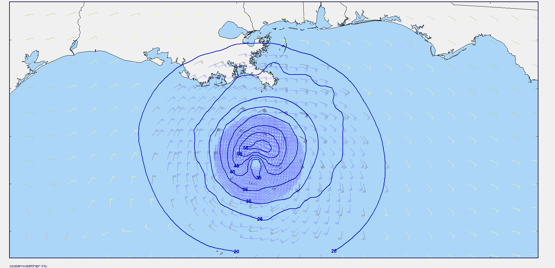
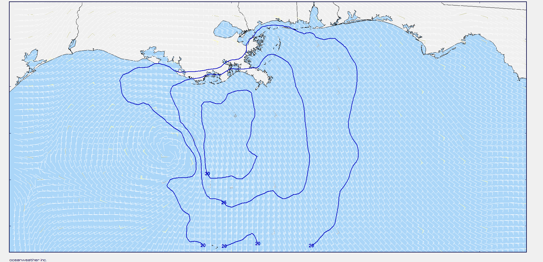
Even though the ECMWF modeling system is considered one of the best global scale atmospheric modeling systems in the world: The OWI wind speeds at this time were 60 knots, while highest winds in the ECMWF model for Hurricane Laura were only 35 knots. This 60 knot wind speed at a 10-meter reference height above MSL, is in agreement with the National Hurricane Center (NHC) 1-minute sustained forecasted wind speed of 75 knots for the same time, although the real-time winds were estimated by NHC to be 77 knots (95 knot for the 1-minute sustained) on August 26th 06 UTC.
Further details on the OWITropPBL Model can be found on our web site at the following link:
For further information about forecast services, please contact the forecast department at forecast@oceanweather.com or by phone at +1 203-661-3091